FireSRnet: Geoscience-driven super-resolution of future fire risk from climate change
 Future wildfire simulations in Northern California
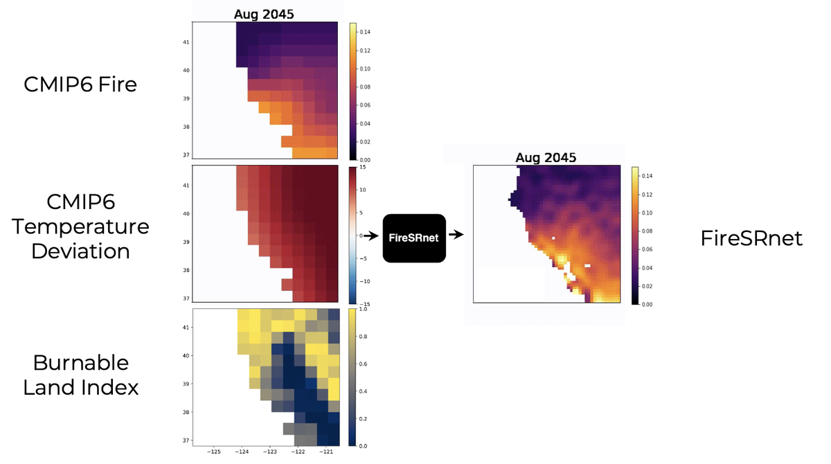
At Sust Global, we developed FireSRnet, a novel super-resolution (SR) architecture operating on a 3-channel geospatial dataset incorporating NASA satellite fire data 🛰, local temperature🌡️, and local land cover burnability🌲.
We compared FireSRnet performance at 2x, 4x, and 8x SR against a benchmark interpolation technique and validated model results with the recent fires in California and Australia.
Then, we showcased how FireSRnet can leverage CMIP6 climate model simulations of burned area and temperature to enable more precise forward-looking estimates of fire exposure 🔥.
- 👉 Check out the blog post I wrote up on this project!
- 🗣️ Check out the talk I gave at NeurIPS!
- 📃 Check out the paper on arXiv!
I presented this work at the 2020 NeurIPS workshop on Tackling Climate Change with Machine Learning and was selected to give a spotlight talk.