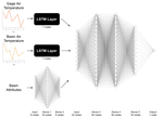
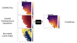
Advances in image super-resolution have led to the ability to generate strikingly photo-realistic images from low-resolution inputs. Inspired by these models, we create high-resolution maps of future wildfire risk, incorporating satellite observations, weather data, and climate models.